Professional Land Surveying
Expertise & Excellence
Delivering precision, accuracy and reliability across Polonnaruwa District and beyond — powered by modern technology and over a decade of field experience.
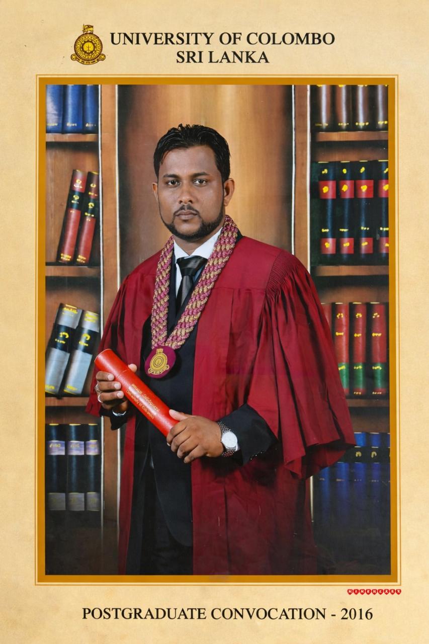
M.R.N.S. Chandrasena
BScHons (Surv Sc) (SUSL), MSc (UoC)
REGISTERED LICENCED SURVEYOR
Leading Registered Licensed
Surveyor in Polonnaruwa
M.R.N.S. Chandrasena is a highly qualified and experienced land surveyor serving the Polonnaruwa District and surrounding regions. With a strong academic foundation and over a decade of hands-on field experience, he delivers comprehensive surveying solutions for residential, commercial, and infrastructure projects across Sri Lanka.
Master's Degree in Geoinformatics
University of Colombo, Sri Lanka
Degree in Surveying
Sabaragamuwa University of Sri Lanka
Complete Surveying Solutions
From residential boundary surveys to complex infrastructure projects — equipped with modern technology and delivered with precision.
Land Surveys & Subdivisions
Creation of new survey plans for legal and banking requirements. Establish or restore property boundaries through on-site mapping and legal descriptions — including historical documents, encroachments, easements, and optimal zoning plans.
Engineering Survey
Survey technology to determine configuration and location of man-made and natural objects. Creation of contour maps to determine topography by accurately measuring point heights and changes in slope across construction sites.
Setting Out & Staking Work
Precise staking on construction projects — from home extensions to industrial and multi-storey buildings. Supporting pipelines, new roads, road rehabilitation, earthworks, landfills and quarries.
Control Establishment & RTK Surveys
Static surveys using GNSS for precise control establishment. Real-time kinematic (RTK) surveys from the Continuous Reference Station, ensuring centimetre-level accuracy in all field conditions.
Drone Mapping
High-resolution aerial surveys using advanced drones to capture accurate geospatial data. Generates detailed maps, 3D models, and elevation data quickly and safely, providing cost-effective, centimetre-level accuracy for surveying, construction, and site analysis.
Certifications & Registrations
Fully registered, licensed and accredited — backed by official certificates from Sri Lanka's leading surveying authorities.
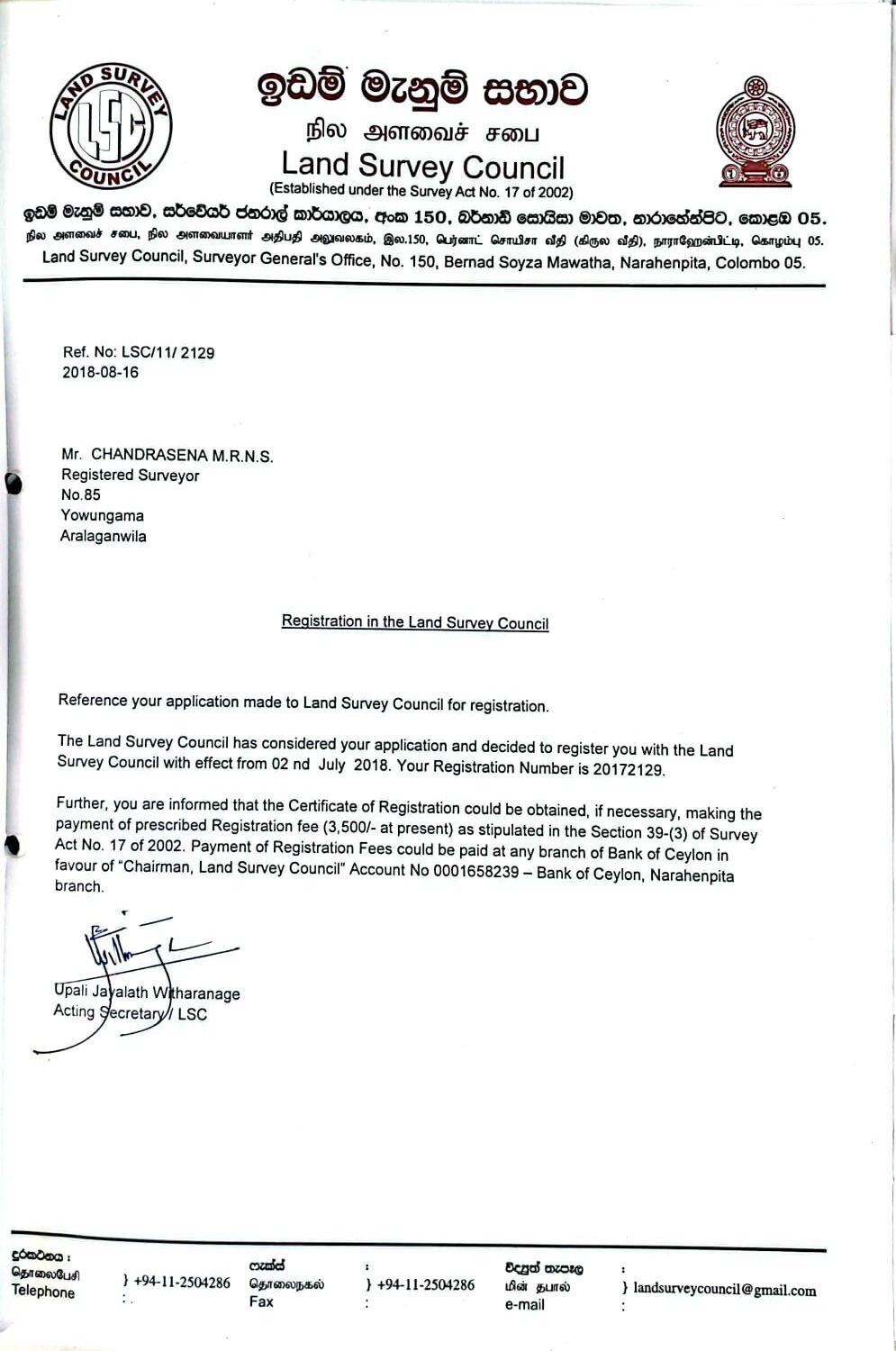
Survey Council Registration
Officially registered with the Land Survey Council of Sri Lanka
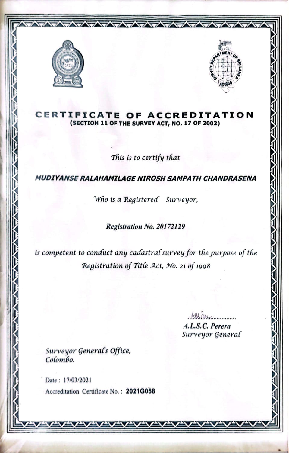
Certificate of Cadastral Survey Accreditation
Officially recognized by the Surveyor General as a Registered Surveyor authorized to conduct cadastral surveys.